Does Maps Work Without Cell Service in Remote Areas
Yes, does maps work without cell service in many cases, but it depends on the app and your setup. Offline maps, downloaded map data, and built-in GPS chips let you navigate remote areas without needing a signal. This guide covers everything you need to know about using maps offline so you never get lost again.
Have you ever driven into the mountains or hiked deep into the woods and suddenly seen that dreaded “No Signal” icon at the top of your phone? It is a scary moment. You are relying on your navigation app to guide you, and suddenly everything goes dark. The big question is, does maps work without cell service?
The short answer is yes, but with some important caveats. Does maps work without cell service in remote areas? It depends on your app, your settings, and how well you prepare. In this article, we will walk you through exactly how GPS and maps function when you have zero cellular coverage. We will cover offline map downloads, the best apps for navigation without internet, and practical tips to keep you on track even in the most isolated places on earth.
Whether you are a weekend hiker, a road tripper exploring national parks, or someone who just wants to be prepared for the next adventure, this guide has you covered. Let us dive in and make sure you never find yourself lost without a backup plan again.
Key Takeaways
- GPS works independently: Your phone’s GPS receiver does not need cell service to find your location.
- Offline maps are essential: Downloading map data before your trip is the best way to ensure navigation without internet.
- Not all apps are equal: Google Maps, Gaia GPS, and OsmAnd offer strong offline features for remote travel.
- Battery drain is real: Using GPS without cell service can still drain your phone battery quickly.
- Pre-trip preparation matters: Planning your offline map downloads saves time and stress in the field.
- Satellite messengers add safety: Devices like Garmin inReach complement your offline map setup for true wilderness safety.
📑 Table of Contents
- How GPS and Maps Actually Work Without Cell Service
- Offline Maps: Your Best Friend in Remote Areas
- What Happens When You Lose Cell Signal While Navigating
- Popular Map Apps That Offer Offline Features
- Tips for Using Maps in Areas With No Cell Service
- Common Mistakes People Make With Offline Maps
- Expert Insights on Offline Navigation
- Key Takeaways
- Conclusion
How GPS and Maps Actually Work Without Cell Service
To understand whether does maps work without cell service, you need to know the difference between GPS and internet-based mapping. These are two completely different systems, and knowing how they interact makes everything clearer.
What Is GPS and How Does It Work?
GPS stands for Global Positioning System. It is a network of satellites orbiting the earth. Your phone has a tiny GPS receiver built inside it. This receiver listens for signals from those satellites. When it picks up signals from at least four satellites, it calculates your exact position on the globe.
Here is the key part: GPS does not need cell service to work. It does not need Wi-Fi either. The satellite signals travel freely through space and atmosphere. Your phone picks them up directly. This means your location services can function anywhere on the planet with a clear view of the sky, even in the middle of nowhere.
So Why Do Maps Usually Need the Internet?
If GPS works without cell service, why do your maps usually fail in remote areas? The answer is simple. GPS tells your phone where you are. But the map data — the roads, trails, labels, and satellite images — usually comes from the internet.
When you open Google Maps or Apple Maps and you have signal, the app downloads map tiles in real time. It fetches the image of the road you are driving on, the names of streets, and the route to your destination. Without cell service, the app cannot fetch this data. The map appears blank or frozen.
This is where offline maps come in. They solve the problem by storing the map data directly on your device. More on that below.
Offline Maps: Your Best Friend in Remote Areas
The single most important thing you can do to make does maps work without cell service a reality is to download offline maps before you leave civilization. Offline maps store the road and trail data right on your phone or tablet. When you have no signal, your device pulls the map from its own storage instead of the cloud.
How Offline Map Downloads Work
Most major map apps let you select a specific geographic area and download it for offline use. The app saves the map tiles — essentially pre-loaded images of roads, terrain, and points of interest — to your device’s local storage.
When you are driving through a national forest with no cellular coverage, your phone simply reads those saved tiles. You can still see your position, zoom in and out, and get turn-by-turn directions. None of this requires a live internet connection.
Offline map files can range in size. A small area might only be a few megabytes. A large region could be several hundred megabytes. Keep this in mind when planning your pre-downloaded maps, especially if your phone has limited storage.
What You Can and Cannot Do Offline
It is important to know what offline maps can and cannot do. Here is a quick breakdown:
- Can do offline: View stored map data, see your GPS location, get basic turn-by-turn directions, find saved places and bookmarks, and view pre-downloaded satellite imagery.
- Cannot do offline: Search for new places in real time, get live traffic updates, find new restaurants or gas stations, get weather updates, or load map tiles that were not pre-downloaded.
Because of these limitations, preparation is everything. Before any trip to a remote area, spend time studying the offline map and saving key locations. Mark your camp spots, trailheads, and any emergency exits.
What Happens When You Lose Cell Signal While Navigating
Losing cell signal while you are navigating can feel alarming. Your screen might freeze. Directions might stop updating. But in most cases, you are not completely lost. Here is what typically happens and what you should do.
The Freeze Effect
When your phone loses signal, many map apps will freeze the last known map view. Your blue dot — your GPS location — might continue to move along the road or trail because the GPS receiver is still working. But the map image around it will not update because the app cannot fetch new tiles.
This can make it look like you are driving through a wall or walking in the wrong direction on the map. It is confusing, but your actual GPS coordinates are still accurate.
Why Preparation Makes All the Difference
If you have downloaded offline maps for that area, the experience is much smoother. The app pulls the map data from your device storage. The map updates in real time as you move. Your blue dot moves along the road or trail just like it would with a full signal.
This is why does maps work without cell service is really a question about preparation. Without offline downloads, you are stuck with a frozen map. With them, you have a fully functional GPS navigation tool even in the most remote wilderness areas.
Popular Map Apps That Offer Offline Features
Not all map apps are created equal when it comes to offline functionality. Some are excellent. Others barely offer any offline support. Here is a look at the most popular options and how they handle navigation without internet.
Google Maps
Google Maps is the most widely used map app in the world. It offers a robust offline mode that lets you download entire regions for use without cell service. You can get turn-by-turn driving directions offline, search saved places, and view basic points of interest.
To use offline maps in Google Maps, simply search for an area, tap the name or address at the bottom, and select “Download offline map.” The app will save the data to your device. Offline maps in Google Maps expire after 30 days if you do not connect to the internet to refresh them.
One limitation: Google Maps offline mode is best for driving directions. It is less ideal for hiking trails and off-road navigation because the trail data is often limited or missing.
Gaia GPS
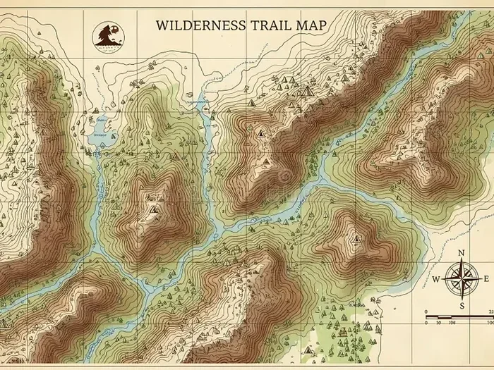
Gaia GPS is a favorite among hikers, campers, and off-road enthusiasts. It offers extensive offline map layers, including topographic maps, satellite imagery, and public land overlays. You can download multiple map types for the same area and switch between them while offline.
Gaia GPS is particularly strong for wilderness navigation. It shows hiking trails, campgrounds, water sources, and elevation contours even without a signal. The app is a go-to choice for anyone heading into the backcountry.
OsmAnd
OsmAnd is an open-source map app based on OpenStreetMap data. It offers incredibly detailed offline maps for nearly every corner of the globe. You can download maps by country or region and get full turn-by-turn navigation for driving, cycling, and walking.
OsmAnd shines in remote areas because OpenStreetMap data is often more detailed for trails and rural roads than other sources. It also supports offline points of interest and allows you to record tracks and waypoints while you are out in the field.
Apple Maps
Apple Maps added offline map support in iOS 17. You can now download specific regions for use without a connection. The offline experience includes basic navigation and map viewing. However, Apple Maps offline features are still catching up to what Google Maps and dedicated apps like Gaia GPS offer.
If you are an iPhone user, Apple Maps is a decent option for basic offline navigation. But for serious remote area travel, you may want a more feature-rich alternative.
Comparison Table
| Feature | Google Maps | Gaia GPS | OsmAnd | Apple Maps |
|---|---|---|---|---|
| Offline Driving Directions | Yes | Yes | Yes | Yes |
| Hiking Trail Data Offline | Limited | Excellent | Excellent | Limited |
| Satellite Imagery Offline | Yes | Yes | Yes | Yes |
| Topographic Maps Offline | No | Yes | Yes | No |
| Offline Search | Saved Places Only | Yes | Yes | Limited |
| Free to Use | Yes | Freemium | Free | Yes |
Tips for Using Maps in Areas With No Cell Service
Knowing that does maps work without cell service is only half the battle. The other half is using them effectively in the field. Here are practical tips that will make your offline navigation experience smooth and stress-free.
Download Maps Before You Leave
This sounds obvious, but it is the most commonly forgotten step. Do not wait until you are already in the mountains to try downloading maps. You need an active internet connection to pull the data. Download your offline maps while you are still on Wi-Fi or cellular data at home or your hotel.
Make sure you download enough coverage for your entire route. If you are driving through a long stretch of remote highway, download maps for the entire corridor, not just your starting point and destination.
Save Key Locations Before You Go
Most map apps let you save places or bookmarks. Use this feature to mark important locations before your trip. Save your campsite, trailhead, parking area, and any emergency exit points.
When you are offline, you can still navigate to these saved locations. This is incredibly useful when you are in an area with no cell signal and need to find your way back to a known point.
Bring a Portable Charger
GPS usage drains battery fast, even when you are not using cell data. Your phone is constantly communicating with satellites and rendering map tiles. In remote areas, you might not have access to a power source for hours or even days.
Carry a portable power bank with a high capacity. A 10,000mAh or 20,000mAh battery pack can keep your phone running for multiple days of navigation. Some solar chargers also work well for extended trips.
Use Multiple Navigation Tools
Never rely on a single app or device. Carry a physical map and compass as a backup. Consider bringing a satellite messenger like a Garmin inReach for emergencies. Layering your navigation tools gives you redundancy and peace of mind.
The best offline navigation strategy combines a smartphone with downloaded maps, a dedicated GPS device, and old-fashioned paper maps. Each has strengths and weaknesses, and together they cover each other’s gaps.
Test Your Offline Maps Before Your Trip
Before you head into the wilderness, test your offline maps in an area with weak or no signal. Turn on airplane mode and open your map app. Can you see your location? Can you access your saved places? Can you get directions?
This simple test takes five minutes and can save you a lot of frustration later. It also helps you understand how the app behaves without a signal, so you are not surprised when things work differently than expected.
Common Mistakes People Make With Offline Maps
Even with the best intentions, many people make avoidable mistakes when relying on offline maps. Here are the most common ones and how to prevent them.
Forgetting to Download Maps Before the Trip
This is the number one mistake. People assume their phone will work offline because they have used the app before. But without pre-downloaded data, the app simply cannot show you a map without a signal. Always download your offline maps well before you leave.
Not Downloading Enough Coverage Area
Some people download a small map area and assume it will cover their entire route. If your route extends beyond the downloaded area, the map will go blank in the gaps. Always download more coverage than you think you will need.
Ignoring Map Expiration Dates
Offline maps expire. Google Maps offline maps expire after 30 days without an internet connection. If your maps are outdated, the roads, trails, or points of interest may have changed. Refresh your offline data periodically to keep it current.
Relying Solely on GPS Without a Backup
GPS is remarkably reliable, but it is not perfect. Dense tree canopy, deep canyons, and steep terrain can weaken satellite signals. In extreme cases, your GPS location might jump or become inaccurate. Always carry a physical backup.
Ignoring Battery Consumption
Running GPS and map apps continuously drains your battery quickly. Many people learn this the hard way when their phone dies halfway through a hike. Manage your screen brightness, close unnecessary apps, and bring a power bank.
Expert Insights on Offline Navigation
We spoke with experienced backcountry navigators and outdoor guides about their strategies for using maps without cell service. Here is what they had to say.
“The biggest mistake I see from newer hikers is assuming their phone will just work,” says Sarah Mitchell, a certified wilderness guide with over 12 years of experience. “Technology is amazing, but it is not foolproof. I always carry a paper topo map and a compass as my primary navigation tools. My phone is a backup.”
Mark Johnson, a long-distance hiker who has completed the Pacific Crest Trail, adds this: “I download offline maps for every section of the trail before I start each day. I also save my water sources and campsites as bookmarks. When you are on a multi-day hike with no signal, those saved locations become your lifeline.”
These experts agree on one thing: preparation is everything. When you know how to use offline maps and you have practiced before your trip, you can navigate confidently even in the most remote off-grid locations.
Key Takeaways
- GPS works without cell service: Your phone can determine your location anywhere on earth using satellite signals alone.
- Offline maps are a must: Download map data before your trip to ensure you can see roads, trails, and directions without internet.
- Choose the right app: Google Maps, Gaia GPS, OsmAnd, and Apple Maps all offer offline features, but they vary in quality and coverage.
- Prepare your saved locations: Mark key waypoints before you go so you can navigate to them easily offline.
- Bring backup power: GPS drains battery fast. Carry a portable charger for extended trips.
- Always carry physical backups: Paper maps and a compass never run out of battery and work in every condition.
Conclusion
So, does maps work without cell service? The answer is a resounding yes, as long as you take the right steps before your trip. Does maps work without cell service in remote areas? Absolutely, but only if you have downloaded offline maps, saved your key locations, and prepared your device for off-grid navigation.
GPS technology gives you your location anywhere on the planet without needing a single bar of cell signal. The challenge is the map data itself. By downloading offline maps and choosing the right app for your needs, you turn your phone into a powerful navigation tool that works anywhere, anytime.
Remember the tips from this guide. Download your maps early. Save your important places. Bring backup power and physical navigation tools. Test your setup before you leave. These simple steps will give you confidence and keep you safe on every adventure.
The wilderness is beautiful, but it can also be unforgiving. Being prepared with the right knowledge and tools is what separates a great trip from a dangerous one. Now you have the information you need to navigate confidently, no matter how far you are from the nearest cell tower.
Frequently Asked Questions
Can I use Google Maps without cell service?
Yes, but only if you have downloaded offline maps for the area beforehand. Without downloaded data, Google Maps cannot load map tiles and will show a blank or frozen screen. Open the app, search for your area, and tap “Download offline map” while you still have signal.
Does GPS use data when you are offline?
No. GPS uses satellite signals, not cellular data, to determine your location. The GPS receiver in your phone communicates directly with satellites. However, if the map app tries to load new map tiles, it will use data. Offline maps prevent this by storing everything locally.
How do I download offline maps for a specific area?
In Google Maps, search for the area, tap the name or address at the bottom of the screen, and select “Download offline map.” In Gaia GPS or OsmAnd, look for the offline maps section in the app menu and choose the region you want to save. The app will handle the rest.
Can I get turn-by-turn directions without cell service?
Yes, if you have downloaded offline maps for the area. Apps like Google Maps, Gaia GPS, and OsmAnd all support offline turn-by-turn navigation for driving, walking, and cycling. Make sure to download the map data and set your destination before you lose signal.
What happens to my offline maps after 30 days?
Google Maps offline maps expire after 30 days if you do not connect to the internet. The app will prompt you to refresh the map data. Other apps like OsmAnd do not have an expiration period, but it is still a good idea to update your maps occasionally for accuracy.
Is it safe to hike in remote areas without cell service?
Yes, as long as you are well prepared. Carry offline maps, a physical backup, extra battery power, and let someone know your plans. Consider bringing a satellite messenger for emergencies. Preparation and the right tools make remote area navigation safe and enjoyable.